The goal of topdowntimeratio is to condense sequences of longitudinal GPS data into segments for ease of processing. This package was developed based on the method outlined in Meratnia and By (2004), and as implemented in McCool, Lugtig, and Schouten (2022).
When it’s released (it isn’t yet), you can install the released version of topdowntimeratio from CRAN with:
install.packages("topdowntimeratio")And the development version from GitHub with:
# install.packages("devtools")
devtools::install_github("daniellemccool/topdowntimeratio")Basic usage requires that your data has at least longitude and latitude coordinates as well as a timestamp and an id column. You can provide the names if they differ from entity_id, lon, lat and timestamp.
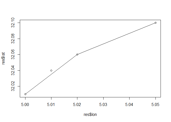
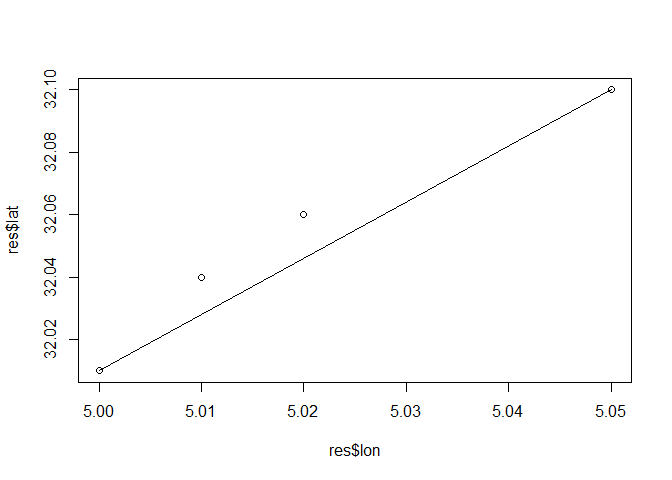
Here we generate a single segment
library(topdowntimeratio)
df <- data.frame(entity_id = c(1, 1, 1, 1),
                 lon = c(5, 5.01, 5.02, 5.05),
                 lat = c(32.01, 32.04, 32.06, 32.10),
                 timestamp = c(500, 600, 800, 2000))

res <- tdtr(df, n_segs = 1, group_col = NULL)

print(res)
#>    entity_id  lon   lat timestamp timestamp_numeric segment_start segment_end
#> 1:         1 5.00 32.01       500               500          TRUE       FALSE
#> 2:         1 5.01 32.04       600               600         FALSE       FALSE
#> 3:         1 5.02 32.06       800               800         FALSE       FALSE
#> 4:         1 5.05 32.10      2000              2000         FALSE        TRUE
#>    adjusted_lat adjusted_lon segment_id seg_start_lat seg_start_lon
#> 1:       32.010     5.000000          1         32.01             5
#> 2:       32.016     5.003333          1         32.01             5
#> 3:       32.028     5.010000          1         32.01             5
#> 4:       32.100     5.050000          1         32.01             5
#>    seg_start_time seg_end_lat seg_end_lon seg_end_time seg_dur seg_dist_lat
#> 1:            500        32.1        5.05         2000    1500         0.09
#> 2:            500        32.1        5.05         2000    1500         0.09
#> 3:            500        32.1        5.05         2000    1500         0.09
#> 4:            500        32.1        5.05         2000    1500         0.09
#>    seg_dist_lon perc_of_seg_dur     dist
#> 1:         0.05      0.00000000    0.000
#> 2:         0.05      0.06666667 2744.752
#> 3:         0.05      0.20000000 3685.078
#> 4:         0.05      1.00000000    0.000
Plot example, initial segment
Plot example, new segment at greatest distance