![]()
Download and plot Open Street Map, Bing Maps, and other tiled map sources. A previous version of this package provided an API for plotting base maps; the new API is more low-level and covers tile math, URL generation, and fetching tiles in parallel.
The rosm package is available on CRAN,
and can be installed using install.packages("rosm").
library(rosm)
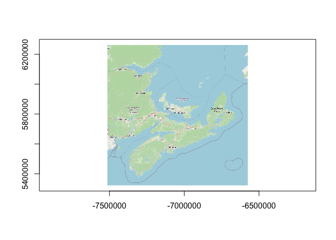
bounds <- wk::rct(
-7476083, 5349058,
-6594103, 6243203,
crs = osm_crs_native()
)
(grd <- osm_raster(bounds, osm_url_spec_example()))
#> <wk_grd_rct [768 x 768] => [-7514066 5322463 -6574807 6261721] with crs=EPSG:3857>
#> List of 2
#> $ data: 'nativeRaster' int [1:768, 1:768] -2108502 -2108502 -2108502 -2108502 -2108502 -2108502 -2108502 -2108502 -2108502 -2108502 ...
#> $ bbox: wk_rct[1:1] [-7514066 5322463 -6574807 6261721]
#> - attr(*, "class")= chr [1:2] "wk_grd_rct" "wk_grd"
plot(grd)